
In this final review of Graham Hancock’s Ancient Apocalypse science fiction series on Netflix, we look at episodes 7 and 8 along with a summary of the series as a whole.
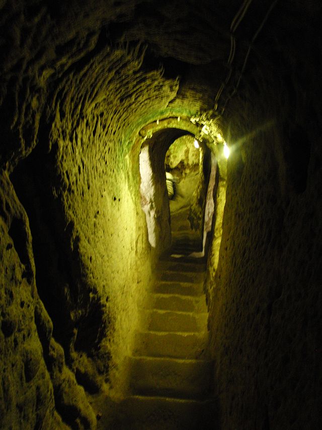
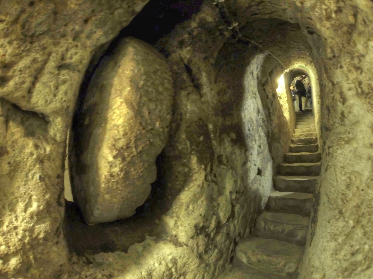
Derinkuyu
This underground city in the Cappadocia region of modern Turkey, carved out of a relatively soft pyroclastic tuff, possibly dates as far back as the Hittites (1600-1180 BCE). Archaeologists think that the city had the capacity to shelter as many as 20,000 people. There are about 8 levels, with the deepest level at around 85 meters.
CC BY-SA 4.0
While there are several vertical shafts for ventilation, there’s only one primary entrance which can be closed off by a movable, circular stone that can be locked into place. In fact, there are quite a few of these circular stone “gates” within the city complex, many of them creating a series of gates every 10 meters for the first fifty or sixty meters of the main entrance.
While Derinkuyu is possibly the most impressive of them, it certainly isn’t the only underground city in the region. Overall, there are at least 127 with at least two levels, 40 of them with more than three levels. The mean distance from one underground settlement to another in the region is about 7 km.
Some of the underground settlements may actually be connected by tunnels, though I’ve been unable to find a source that confirms it. Around 20 minutes into episode 7, Hancock says, “this blocked tunnel is claimed by some to connect Kaymakli to Derinkuyu”. It’s his most “mind-blowing” aspect of the Kaymakli underground settlement, in spite of no way to confirm it.
Hancock, of course, dates the site of Derinkuyu to the last Ice Age using the because-why-couldn’t-it-be method of dating. It’s true that dating the site directly has yet to be done due to the lack of organic materials for radiocarbon dating. And dating the worked stone would be silly since these are Miocene deposits (~10 Ma) created well before humanity.
(CC BY-SA 3.0)
Most archaeologists are reasonably sure that the majority of the Derinkuyu constructions occurred between the 6th and 16th centuries CE and was occupied by Christians as protection from Muslim Arabs during the Arab-Byzantine wars (780-1180 CE) and the Mongolian incursions in the 14th Century CE. But they also readily agree that these underground settlements were initially created much earlier.
Based on the amount of carving and excavation required, archaeologists are also fairly certain iron picks and implements were used to create the living spaces. Human settlements on the surface do date back to the Neolithic (~8,000 BCE) but there are no indications that they would have 1) needed to hide from an enemy, or 2) were large enough to create the caverns using non-metal tools. They would have been limited to hand axes made of hard igneous rock and construction would have been less efficient.
Still, it is possible.
And because of this, Hancock says it is so. Without question. To justify his claim, he say’s.
Only a highly motivated culture would have undertaken such a task. What kind of threat would have been so devastating that it could compel an entire people, possibly hundreds of thousands of them, to carve out a new life underground?
Graham Hancock, Ancient Apocalypse episode 7
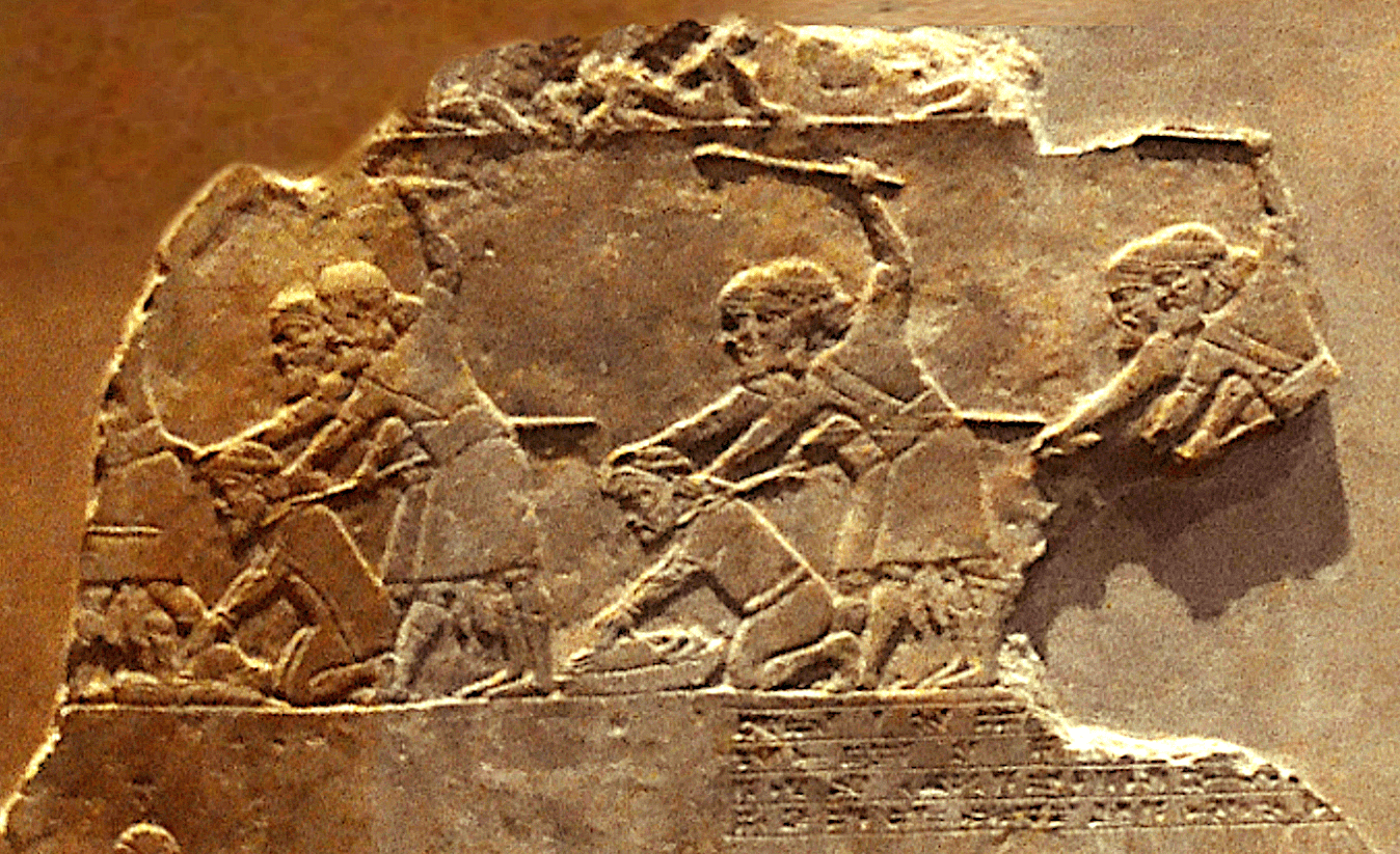
Photo by Carole Raddato (CC BY-2.0)
I find this question remarkable because he just told us what would be so highly motivating in the minutes of the episode leading up to this question. Attackers from neighboring kingdoms: Hittites during the 16th-14th centuries BCE were subjugating people of Anatolia; the Assyrians were notably brutal toward enemies in more recent periods that followed; and certainly the even more recent Arab-Byzantine wars were cause to keep families and loved ones safe.
These are all motivators for creating an underground complex were entire surfaces settlements can vanish to. An invading army that will impale men, women, and children of your village and force captors to grind the bones of their own families, is what some might call a highly motivating factor.
Hancock sees this as a place to escape from his imagined comet that threatened the planet. The reasonable question is how would they know there’s a need to go underground even if they could see the comet in the sky for weeks. Hancock’s answer is someone told them. Someone from a “lost, advanced civilization” that he still doesn’t define, but at least now we know they have the alleged ability to understand the mass and physics of a comet.
That’s not far-fetched at all.
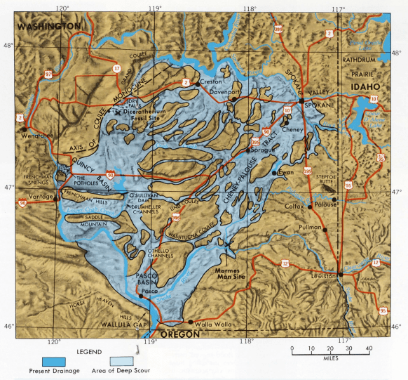
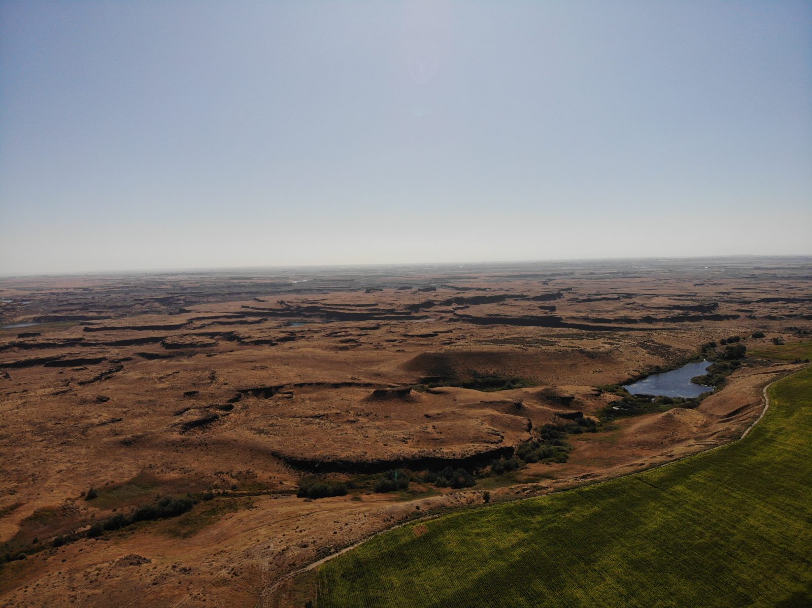
The Channeled Scablands
The Channeled Scablands are mostly a barren, rocky, series of waterfalls and drainages left over from the 40 or more large-scale floods that resulted from the melt-water of the Last Glacial Maximum. This section of Washington state was eroded out and carved up between 18,200 and 14,000 years ago
In the 1920s, geologist J. Harlen Bretz theorized that the Scablands were created by a cataclysmic flooding event that was brief but immense and it initially met with stiff opposition in his field, mostly because he didn’t propose a mechanism that was the cause. J.T. Pardee came along a few years later, agreeing with Bretz, but proposing the flood waters originated from a glacial lake. Over the next few decades, Pardee collected data and eventually identified Lake Missoula as the source.
Bretz and Pardee had an extraordinary claim, but they produced the extraordinary data to back it up.
Hancock’s Non-Experts
Hancock interviews some guy named Randal that claims all the water came in one flood instead of many floods as geologists have concluded based on stratigraphy and deposition within the region. But he doesn’t really justify with evidence why this would be the case.
Naturally, this really fit well with Hancock’s conclusion that his “lost, advanced civilization” was wiped out 12,800 years ago, so that’s when it all happened. All at once.
But there could be as many as 100 floods in the Scablands due to the melting of ice (Waitt 1994). Some of the floods may have even occurred as far back as 1.5 million years ago (Spencer 2002). The most recent major flood event in the Scablands was approximately 13,000 years ago, which is certainly consistent with the end of the Younger Dryas period, but based on core sampling and stratigraphy, many flooding events occurred between 18,000 and 13,000 years ago.
Near the end of this final episode, Hancock brings on another random guy to talk about “black mat” stratigraphy that supposedly “stunned the scientific community in 2007” and contained melted glass spherules, platinum, and iridium.
These black mat layers are organic-rich soils alleged to be found at archaeological sites all across North America and also alleged to be deposited at the same time, right at boundary of the Younger Dryas. This, Hancock and the guy he interviewed agreed was proof positive that a comet catastrophe happened at the end of the Younger Dryas, wiping out Hancock’s alleged “lost, advanced civilization” along with “50 to 60% of the people across the northern hemisphere.”
Except there are some problems with the claims.
The “black mat” stratigraphy is an indication of wetlands in the past, which act as effective dust traps, particularly in arid environments. Pigati et al (2012) found that iridium was just as likely to be found in other black mat strata in other places of the world that correlate to other periods. And Paquay, et al (2009) had already discovered “the sloping patterns obtained for all samples of the YD black layer strongly resemble the pattern typical of average continental crust” when it came to platinum group elements.
Then, in 2020, Jorgeson, Breslawski, and Fisher tested the synchronous claim of carbon-14 measurements done by Kennett et al (2015). They found the data failed to “support the claim that there was an extraterrestrial impact ~12,800 cal yr BP that was responsible for Younger Dryas climatic cooling, Terminal Pleistocene megafaunal extinctions, widespread burning, and the disappearance of the Clovis archaeological culture. “
There may well have been a comet or asteroid impact at or around the YD boundary that influenced the environment. The evidence presented thus far, however, is neither necessary or sufficient to explain what is currently observed in the archaeological and geological records related to that period.
Graham Hancock came to the table with a conclusion. The data he tries to fit to this conclusion are either misunderstood, misrepresented, or incomplete. Data that are contrary are simply ignored.
References and Further Reading
Aydan, Ö., and R. Ulusay (2016). “Rock Engineering Evaluation of Antique Rock Structures in Cappadocia Region of Turkey.” Paper presented at the ISRM International Symposium – EUROCK 2016, Ürgüp, Turkey.
Ayhan, Arda (2004). Geological and Morphological Investigations of the Underground Cities of Cappadocia Using GIS. Graduate School of Natural and Applied Sciences of Middle East Technical University: Masters Thesis.
Jorgeson I.A., R. P. Breslawski, A. E. Fisher (2020). “Radiocarbon simulation fails to support the temporal synchroneity requirement of the Younger Dryas impact hypothesis”. Quaternary Research. 96: 123–139.
Kennett, J.P., et al (2015). Bayesian chronological analyses consistent with synchronous age of 12,835–12,735 Cal B.P. for Younger Dryas boundary on four continents. Proceedings of the National Academy of Sciences of the United States of America 112, E4344– E4353.
Mullineaux, D. R., Wilcox, R. E., Ebaugh, W. F., Fryxell, R., & Rubin, M. (1978). Age of the Last Major Scabland Flood of the Columbia Plateau in Eastern Washington. Quaternary Research, 10(02), 171–180.
Paquay F.S., et al (2009). Absence of geochemical evidence for an impact event at the Bølling-Allerød/Younger Dryas transition. Proceedings of the National Academy of Sciences of the United States of America, 106, 21505–21510.
Pigati J.S., C. Latorre, J. A. Rech, J. L. Betancourt, K. E. Martínez, and J. R. Budahn (2012). Accumulation of impact markers in desert wetlands and implications for the Younger Dryas impact hypothesis. Proceedings of the National Academy of Sciences of the United States of America, 109(19), 7208–12.
Sahin, E., & B. I. Aksulu (2015). A study on conservation of architectural housing units in the context of sociocultural structure and alteration: case of Cappadocia–Güzelyurt/Turkey. Architectural Science Review, 59(1), 27–38.
Spencer, P. K.; M. A. Jaffee (2002). Pre-Late Wisconsinan Glacial Outburst Floods in Southeastern Washington—The Indirect Record. Washington Geology. 30(1/2), 9–16.
Waitt, R. B., Jr. (1994). Scores of Gigantic, Successively Smaller Lake Missoula Floods Through Channeled Scabland and Columbia Valley, in Geologic Field Trips in the Pacific Northwest: 1994 Geological Society of America Meeting, Chapter 1K, D. A. Swanson and R. A. Haugerud (eds.), Geological Society of America, Boulder, Colorado.
Yamac, Ali (2017). Underground Settlements and Cave Fwellings of agirnas Village, Kayseri (Southeast Turkey). Hypogea: Proceedings of the International Congress of Speleology in Artifical Cavities.
Leave a Reply
You must be logged in to post a comment.